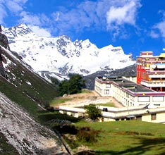
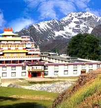
 In
the eastern Himalayas, Sikkim is a lovely state located in the
unfathomable mountains and abrupt valleys. Sikkim is placed between
latitudes of 27°5' N to 20°9' N and longitudes of 87°
59' E to 88°56' E. Positioned in north-east, Sikkim is the second
smallest state of India. Sikkim is sandwiched between Nepal in the west
and Bhutan in the east, China in the north and West Bengal in the south.
The Indian border of Sikkim is shared only with the state of West
Bengal.
In
the eastern Himalayas, Sikkim is a lovely state located in the
unfathomable mountains and abrupt valleys. Sikkim is placed between
latitudes of 27°5' N to 20°9' N and longitudes of 87°
59' E to 88°56' E. Positioned in north-east, Sikkim is the second
smallest state of India. Sikkim is sandwiched between Nepal in the west
and Bhutan in the east, China in the north and West Bengal in the south.
The Indian border of Sikkim is shared only with the state of West
Bengal.Oblong in its shape, Sikkim lengthens 100 kms approx. from north to south and broadens 60 kms approx from east to west. Sikkim covers an area of 7,096 km². Highly dominated by mountainous terrain, Sikkim gets water from rivers like Teesta and Rangeet. Roughly three-quarters of its perimeter, enfolds the east and the west, incorporating the complete northern borderline. The southern fringe of Sikkim is the only liberated edge that is open to West Bengal.
The whole setting makes a horseshoe corral, which acts as a trap for moisture-laden winds from the Bay of Bengal. Consequently, Sikkim receives plenty of rain showers round the year. With the elevation ranging from 280 m (920 feet) to 8,585 m (28,000 feet), Sikkim has diverse climate ranging from tropical to tundra. The geographical statistics of Sikkim is probably the reason for the rich collection of flora and fauna in this small state.
Kanchenjunga peak makes the crown of this state. Being rocky, the area is not adequate for farming and agriculture. Several snow-fed streams have resulted into river valleys in the west and south of Sikkim. One-third land of Sikkim is covered with forests. Sikkim boasts of 28 mountain peaks, 21 glaciers, 227 high-altitude lakes, 5 hot springs and more than 100 streams. In the lower Himalayas, Inhabitants have occupied the southern part of Sikkim.


